
Weather Briefing — Atco, NJ 08004
- Updated: Wednesday, October 14, 2026 6:00 PM Eastern
- Next update: Wednesday, October 14, 2026 7:00 PM Eastern
- Generated: 2026-10-14T22:03:18+00:00
- Type: weather
Headline
A warm, humid Wednesday evening with a slight chance of a lingering shower or storm gives way to a brief cool-down Thursday — but the big story is a strong cold front arriving Friday evening with showers, a few thunderstorms, and gusty winds, followed by the coldest airmass of the season this weekend and the first widespread frost/freeze threat Saturday night.
Forecast Area
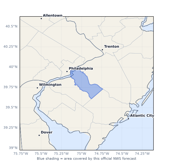
The official NWS forecast for Atco is issued for forecast zone NJZ018 (Camden County, NJ), covering the Camden County suburbs of the Philadelphia metro area.
Active Alerts
No active watches, warnings, or advisories for Atco or Camden County. The nearest official hazard products are marine-focused: a Small Craft Advisory for the Atlantic coastal waters from Cape May to Fenwick Island beginning 5 AM Thursday, and a Gale Watch for all Atlantic waters and Delaware Bay Friday night through Saturday as the strong cold front pushes offshore. These do not cover inland Atco, but they signal how strong the post-frontal winds will be.
Current Weather
Atco is dry, warm, and humid this evening under a decaying post-frontal shower regime.
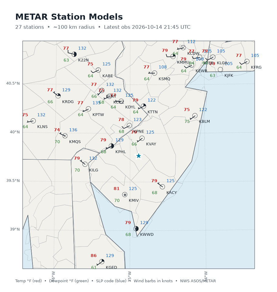
Surface observation (KVAY – Mount Holly/South Jersey Regional Airport, 12.1 miles from Atco, observed 21:45 UTC / 5:45 PM EDT): - Temperature: 79°F (26.0°C); dewpoint 66°F (19.0°C); relative humidity 65% - Wind: WSW at 6 mph (240°) - Pressure: 29.90 inHg (1012.5 mb) - Sky: Clear (CLR at 12,500 ft); visibility 10 miles - Present weather: none; no precipitation in the past 1/3/6 hours
Precipitation (MRMS, 21:58 UTC): No surface precipitation at Atco or anywhere within a 30 km analysis radius — 0.0 mm/hr, 0% coverage. The nearest MRMS surface precipitation is 63.9 km away and the nearest radar echo is 65 km away, so any earlier shower activity has fully exited the area.
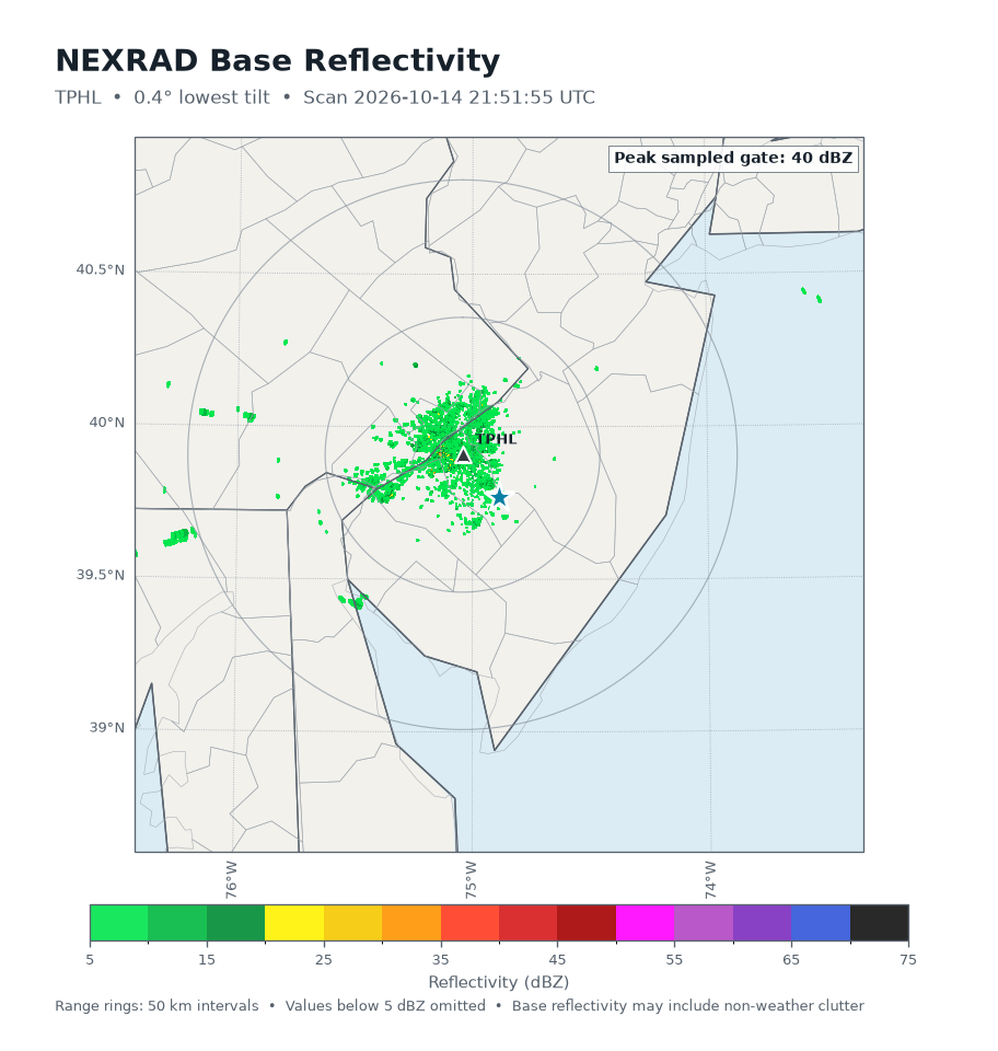
Radar (NEXRAD TPHL – Philadelphia, 20.3 km away, scan 21:51:55 UTC): The lowest tilt (0.4°) shows only weak residual echoes — mean reflectivity around −2 dBZ with an isolated max of 40.5 dBZ aloft, and zero gates at or above 50 dBZ. Beam height over Atco is only ~191 m MSL, so sampling is excellent. This is consistent with leftover elevated debris or very weak non-precipitating echoes, not active rain over the area. The deterministic diagnosis confirms: no precipitation at or near the location, no convective character, no hail signal, and no virga indication (dewpoint depression a modest 6.8°C).
Lightning (GOES-19 GLM, 21:51–22:01 UTC): Zero flashes within 50 km in the past 10 minutes; trend steady. No electrically active storms nearby.
Regional surface pattern (METAR station models, 21:45 UTC): A broad warm, humid airmass sits over the region — KVAY 79/66, KPHL 79/68, KACY 79/68, KMIV 81/70, KILG 79/70, with Georgetown, DE already at 86°F. Dewpoints in the mid-to-upper 60s across South Jersey reflect the moist airmass ahead of tonight's frontal passage. Pressures are uniform around 1010–1013 mb with light WSW flow.
Current Synoptic Setup
Per the NWS Mount Holly Area Forecast Discussion (issued 2:59 PM EDT Wed Oct 14):
- Surface: Low pressure tracking across northern New England is moving into Nova Scotia tonight, with its trailing frontal boundary extending southwest into the Ohio Valley. That front is sinking south across the region this evening — it has already knocked temperatures down into the 70s in many spots after an earlier round of showers and rumbles of thunder. A few showers remain possible in southern areas through early evening before diminishing.
- Behind the front: Cooler air briefly returns tonight into Thursday, with lows in the 50s and partial clearing. The front then stalls and works slowly back north late Thursday, keeping Thursday mostly dry but setting up a warm return flow.
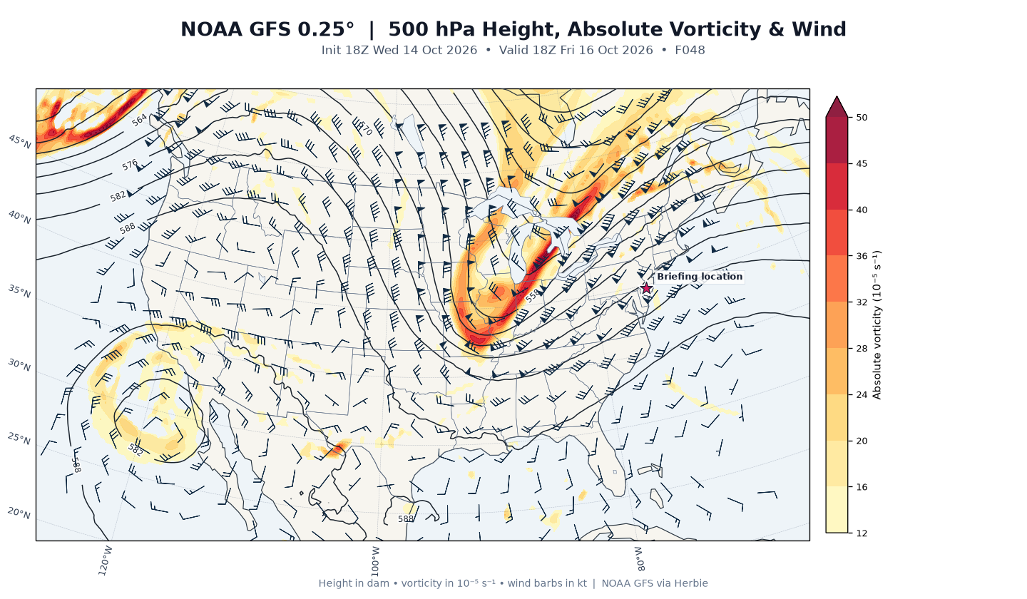
- The main player: A sharp upper-level trough arrives across the East Coast Friday, driving rapidly strengthening surface low pressure just north of the area with a strong cold front sweeping through Friday evening (4–8 PM window). Ahead of it, strong warm advection boosts temperatures into the 70s and low 80s with a warm, increasingly moist airmass, modest instability, and decent boundary-layer mixing — enough for a line or broken line of showers and storms along/ahead of the front, with some severe thunderstorm potential not ruled out. Behind it, strong cold advection and efficient mixing of 40–50 mph boundary-layer winds aloft bring gusts of 30–40 mph overnight into Saturday morning.
- Airmass change: The coldest airmass of the season settles in Saturday into Saturday night, with widespread frost and freeze conditions increasingly likely Saturday night — the Pine Barrens (just southeast of Atco) could approach freezing.
GFS Guidance
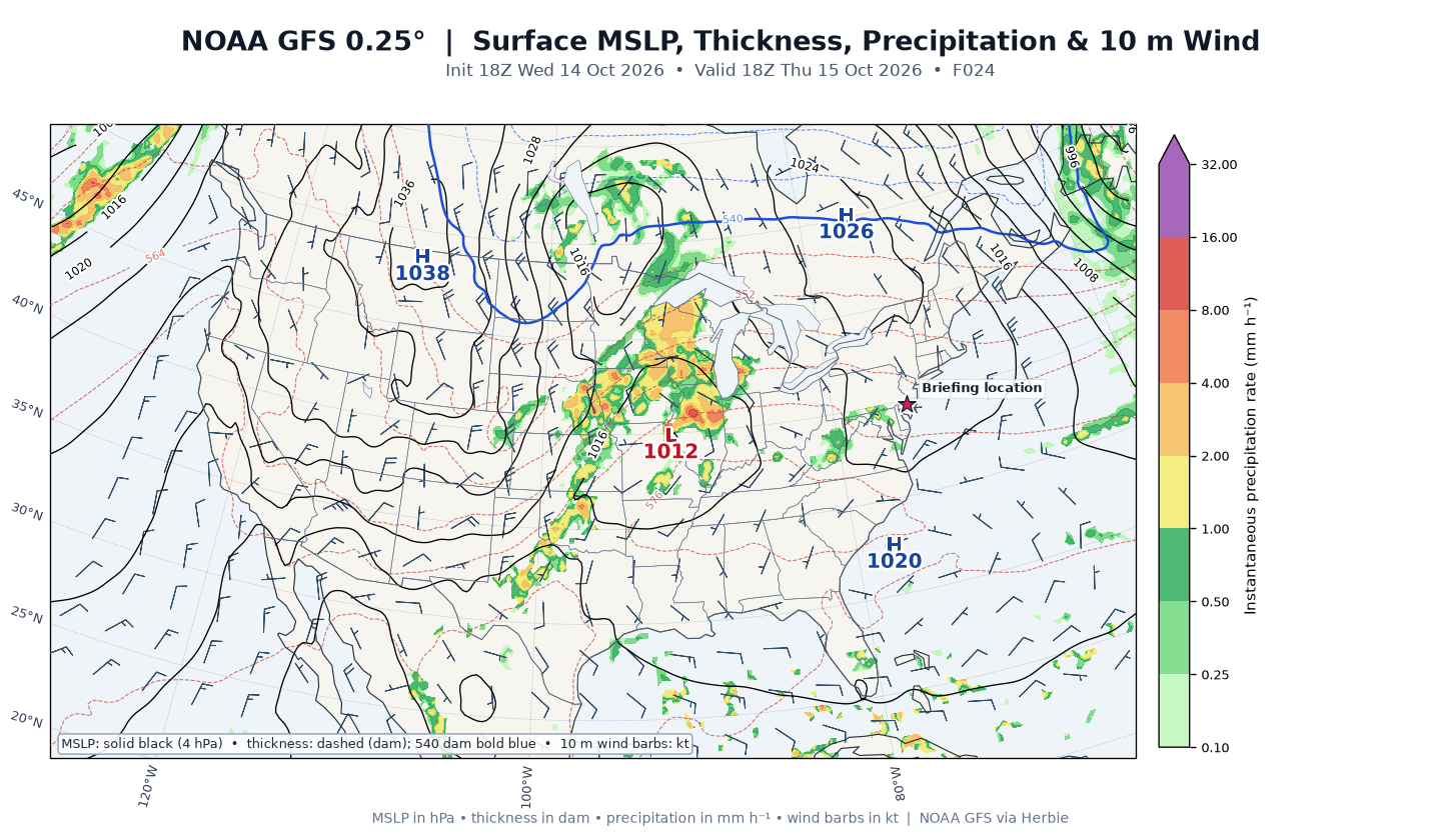
GFS cycle: 2026-10-14 18Z (leads 24, 48, and 72 h valid 18Z Oct 15/16/17).
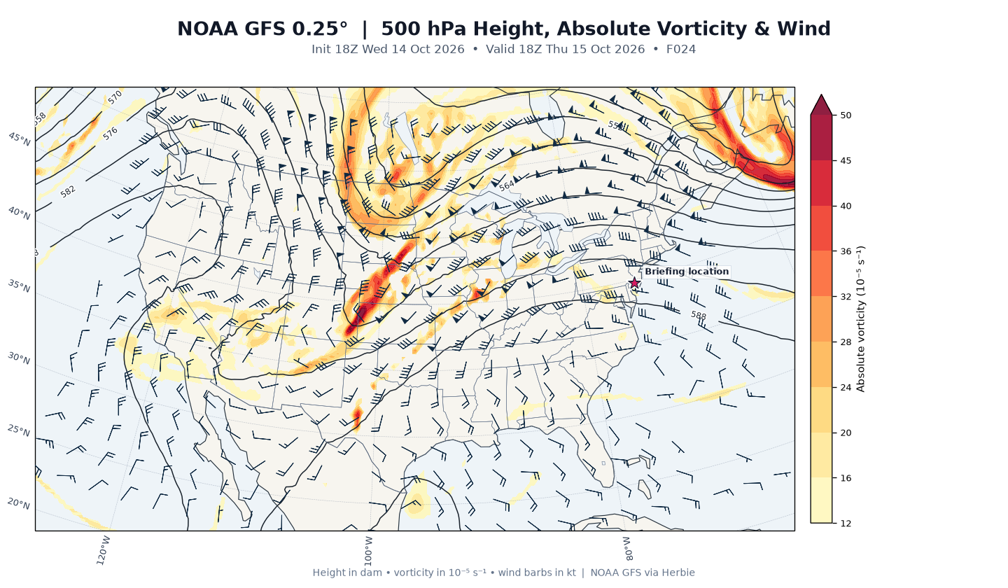
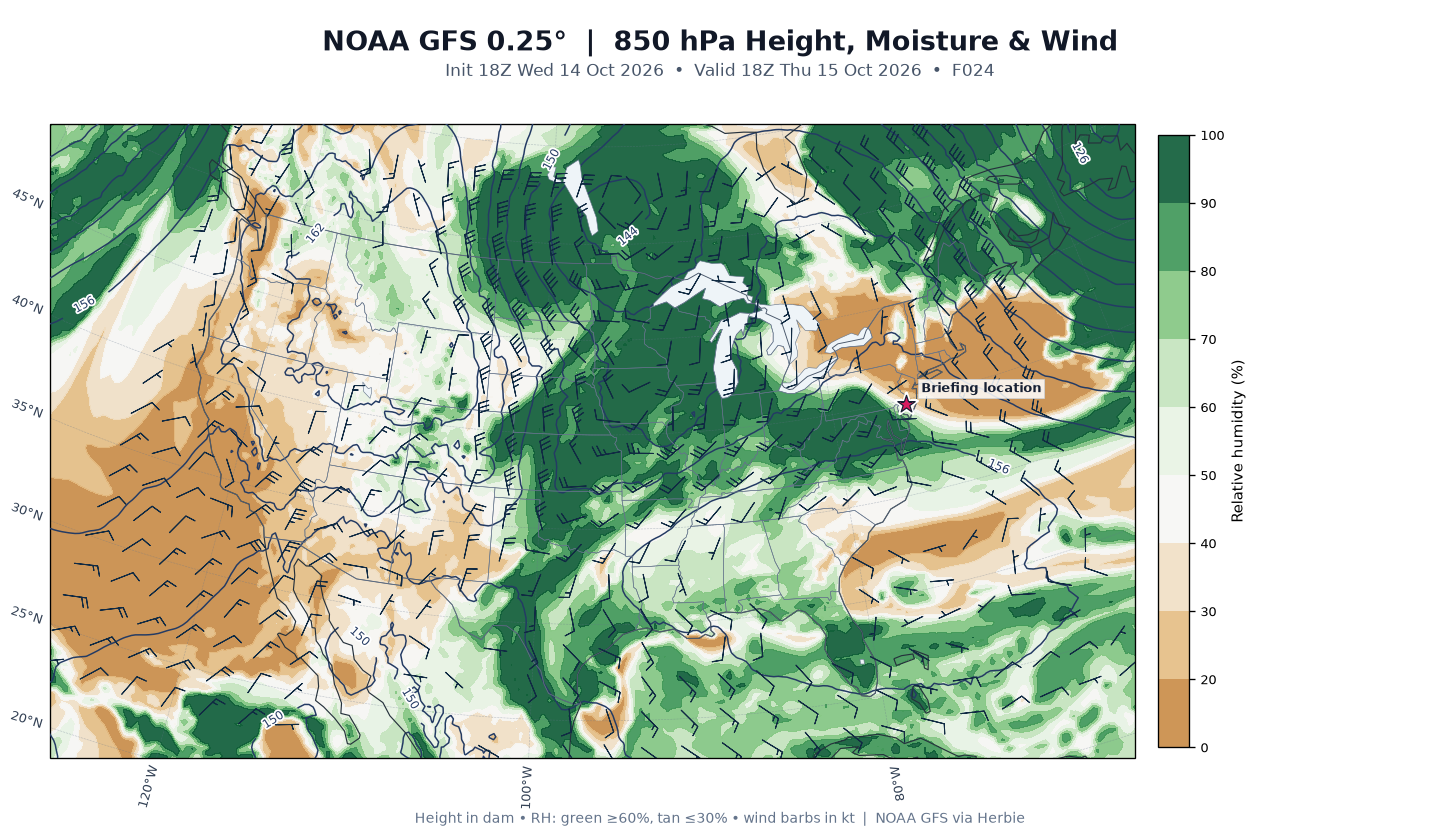
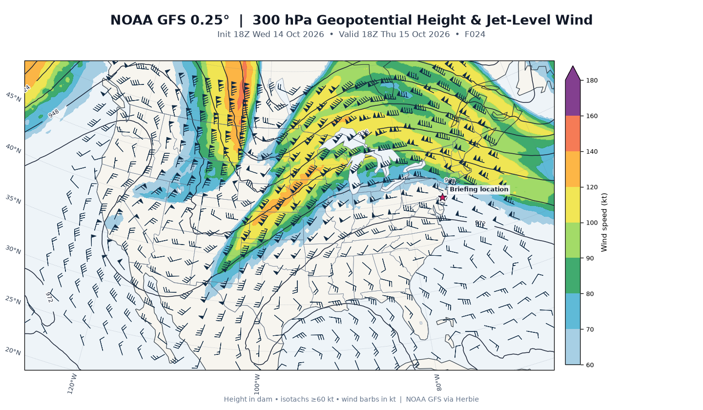
Day 1 (Thu, F24 – 18Z Oct 15): Quiet and cool. Point guidance: 2-m temperature 21.4°C (≈71°F), dewpoint 10.1°C (≈50°F), MSLP 1021.6 mb, light 3-kt wind, no precipitation. The surface chart shows high pressure in control; 500-mb heights 585 dam with modest vorticity (13.9×10⁻⁵ s⁻¹) and 31-kt flow — a benign, weakly ridged pattern. 850-mb relative humidity is a dry 38% with only 8-kt flow, and the 300-mb jet is a modest 53 kt. This matches the NWS "mostly sunny, high near 67" Thursday forecast (GFS 18Z point value runs a bit warm vs. the official forecast).
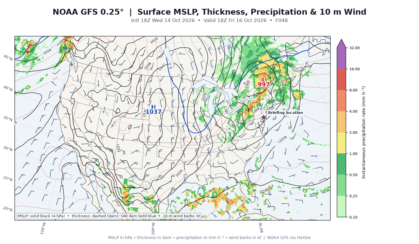
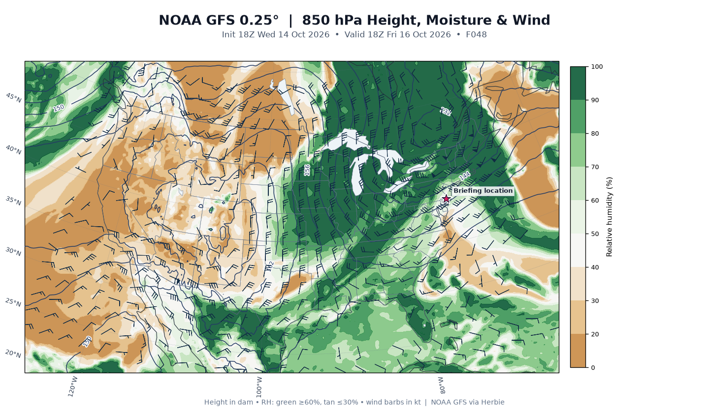
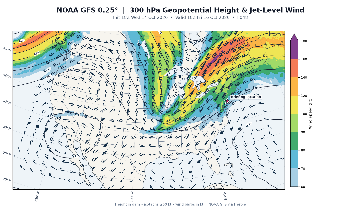
Day 2 (Fri, F48 – 18Z Oct 16): Dramatic pattern amplification. Point guidance: temperature 25.6°C (≈78°F), dewpoint up sharply to 17.9°C (≈64°F), MSLP crashing to 1006.7 mb, 12-kt wind. 500-mb heights fall to 577 dam with 59-kt flow — the sharp trough arriving. 850-mb RH jumps to 63% with a strong 32-kt southwesterly low-level jet (warm/moist advection surge), and the 300-mb jet intensifies to 78 kt — classic strong-front dynamics. No precipitation at exactly 18Z, consistent with the forecast break in convection by midday before the evening frontal line.
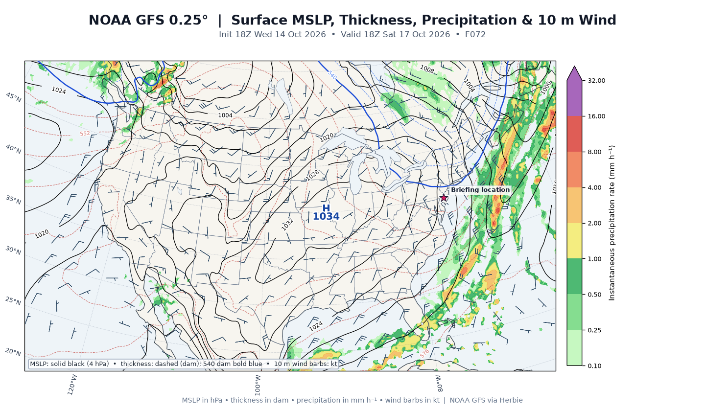
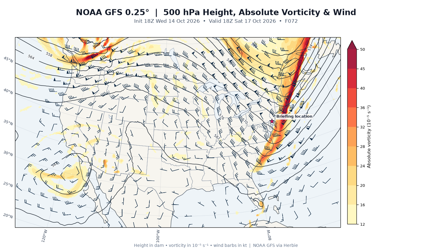
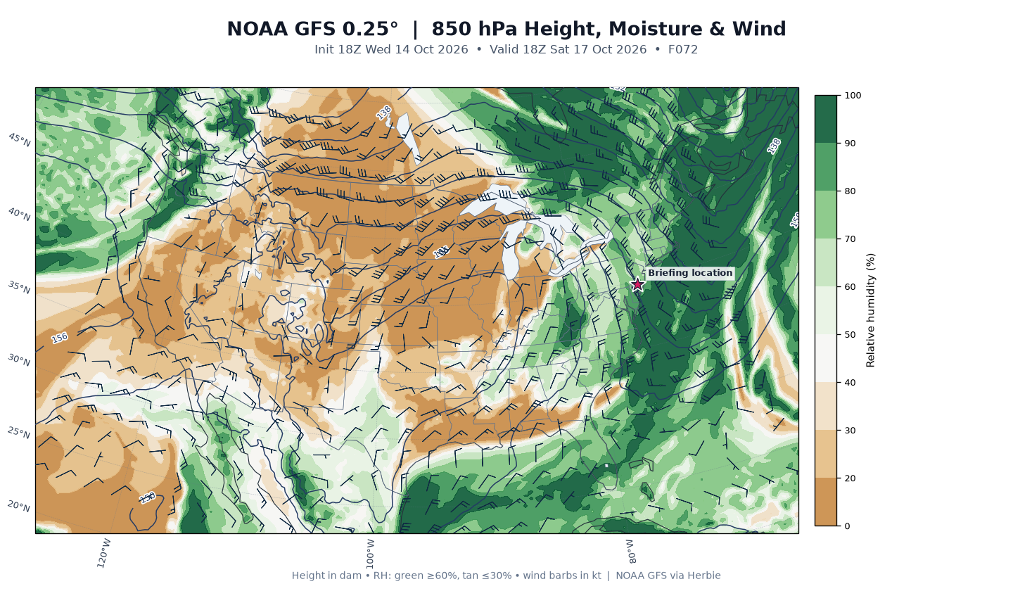
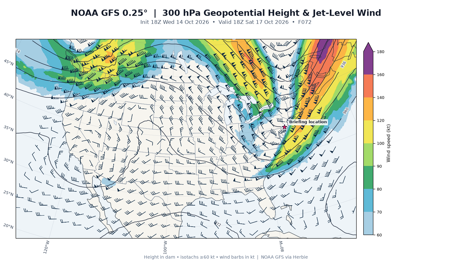
Day 3 (Sat, F72 – 18Z Oct 17): Post-frontal cold. Point guidance: temperature plummets to 12.0°C (≈54°F) with dewpoint −3.6°C (≈26°F) — a ~30°F dewpoint drop in 24 hours — MSLP rebounding to 1022.6 mb under building high pressure, 14-kt wind. 500-mb heights dig to 561.6 dam (deep cold trough overhead), 850-mb RH 68% with lingering 27-kt NW flow (cold advection/mixing), and the 300-mb jet relaxes to 35 kt. This is the season's coldest airmass arriving exactly as the AFD describes.
HRRR Analysis
All HRRR data below are model guidance from the 21Z Oct 14 cycle (valid 21:00 UTC), at the HRRR grid point 0.36 km from Atco — not balloon observations.
Surface thermodynamics: 27.1°C (80.8°F) / dewpoint 20.3°C (68.5°F), surface pressure 1007.4 mb — closely matching the KVAY observation and confirming the warm, moist pre-frontal airmass. Precipitation type guidance: none, with 0.0 mm/hr.
Vertical structure: Freezing level at 4,250 m MSL (~14,000 ft) — no winter-weather concerns whatsoever. The profile is moist through mid-levels (RH peaking ~95% near 525 mb) but relatively dry in the lowest 1–2 km, consistent with the post-shower lull. Max temperature aloft 26.2°C; a single freezing crossing, no warm nose, no frozen precipitation.
Instability: Surface-based CAPE 719 J/kg with zero CIN (most-unstable parcel identical); mixed-layer CAPE 133 J/kg with −143 J/kg ML CIN; DCAPE 551 J/kg. The HRRR flags this as not meaningful instability — modest, marginal buoyancy typical of an October warm sector, but with zero inhibition any parcel that reaches the LFC can rise freely. LCL at 917 m (873 m AGL — low), LFC at 1,940 m, EL near 9,200 m.
Shear and lapse rates: This is the standout feature — 0–6 km bulk shear of 47.7 kt (0–1 km: 19.5 kt; 0–3 km: 37.6 kt), flagged as strong deep-layer shear. Winds veer from westerly at the surface through WSW at 925 mb (24 kt) to W at 500 mb (54 kt) and WNW at 250 mb (86 kt). Lapse rates are moderate: 6.4°C/km surface-to-3 km and 6.4°C/km through the 700–500 mb layer. K index 34.1, Total Totals 48.5, precipitable water 46.1 mm (1.82 in) — a moisture-rich column for mid-October.
Interpretation: Modest CAPE + strong shear + low LCLs + 1.8 inches of precipitable water is a favorable alignment for organized shower/storm lines along Friday evening's front — the same setup the AFD cites when noting severe potential "cannot be ruled out." Right now, though, the environment is quiet with no active convection.
Outlook
The Mount Holly AFD frames the next three days around three key messages:
- Tonight/Thursday: The cold front sinks south this evening, ending the shower threat and yielding a cooler, mostly sunny Thursday with uniform low-to-mid 60s and onshore flow. The front then works slowly back north late Thursday — only a few showers possible over Delmarva, so Atco should stay dry.
- Friday: The sharp upper trough arrives; rapidly strengthening surface low passes just north of the area with a strong cold front sweeping through Friday evening (4–8 PM), moving west-to-east across the zones in roughly 3 hours. A warm-advection shower/thunder round is expected overnight Thursday night into early Friday morning, a midday break, then a line or broken line of showers/storms along or ahead of the front — severe potential cannot be ruled out. Pre-frontal gusts of 20–30 mph; post-frontal gusts of 30–40 mph likely overnight into Saturday morning (a Wind Advisory was considered but the threat has lessened with the later timing). Marine: Gale Watch Friday night–Saturday.
- Saturday night: Widespread frost and freeze conditions increasingly likely — lows in the 30s region-wide, upper 20s north of I-78. A hard freeze appears unlikely south of I-78, but the Pine Barrens cold spots near Atco could drop to near freezing. Frost is anticipated across NJ, PA, and northern DE. The airmass modifies Sunday with highs rebounding to mid-50s–near 60, then near-normal 60s and dry weather early next week.
Confidence is high in the overall pattern evolution; the main forecast nuances are the exact timing of Friday evening's frontal line and how strong the post-frontal wind gusts become.
Forecast for Next 3 Days
Today (Wednesday, Oct 14) — this evening
- High near 82°F (already 79°F at 5:45 PM), falling through the 70s and 60s this evening.
- Slight chance (≈20%) of showers and thunderstorms through about midnight — hourly PoPs peak at 22% around 9–10 PM, then drop to 3–4% after 1 AM. Rainfall amounts under a tenth of an inch.
- Wind: W/NW 5–10 mph. Skies: partly sunny → mostly cloudy, clearing trend overnight. Low around 55°F.
Day 1 — Thursday, Oct 15
- Mostly sunny and much cooler: high near 67°F (hourly values peak 65–66°F early-to-mid afternoon), low Thursday night around 55°F.
- Wind: light N/NE around 5 mph, turning E-SE in the afternoon. Humidity comfortable (RH 56–65% midday).
- Dry all day (PoP ≤4%); the front stays south. Clouds increase late.
- Thursday night: clouds thicken and rain chances rise — chance of rain showers after 8 PM, then showers and thunderstorms likely (60%) toward dawn as the warm-advection surge aloft arrives. SE wind around 5 mph. Amounts under a tenth of an inch.
Day 2 — Friday, Oct 16
- Warm and humid ahead of the front: high near 79°F (hourly peak 78–79°F mid-afternoon), with dewpoints climbing to ~70°F and RH near 100% in the morning.
- Morning: showers and thunderstorms likely before/around dawn (PoP 50–60% 2–6 AM), then a midday break (PoP ~10–17% late morning through mid-afternoon).
- Afternoon/evening: the main event — a chance of showers and thunderstorms from ~5 PM (PoP 50%), becoming showers and thunderstorms (80%) after 8 PM as the strong cold front crosses. Rainfall a tenth to a quarter inch possible.
- Wind: S/SW 5–15 mph with gusts to 25 mph ahead of the front, shifting W/NW and gusting higher overnight. Low around 48°F — temperatures plummet through the 50s and 40s behind the front.
Day 3 — Saturday, Oct 17
- Sharply colder: high only near 55°F (hourly values hold in the upper 40s to mid 50s), with a low Saturday night around 37°F and patchy frost after 8 PM.
- Morning: a chance (≈40%) of lingering rain showers before 8 AM, then mostly sunny as high pressure builds.
- Wind: NW 15–20 mph with gusts 30–40 mph possible in the morning per the AFD, gradually diminishing later in the day. Dewpoints crash into the 20s and low 30s (°F) by afternoon — very dry air.
- Saturday night: mostly clear, calm (N 5–10 mph), patchy frost — the Pine Barrens cold spots near Atco could approach freezing.
Bottom Line
Right now Atco is dry and warm (79°F at KVAY) with only a slight (≈20%) chance of a stray shower or storm through about midnight as tonight's weak front slides south. Thursday is the pick of the week — mostly sunny, near 67°F, and dry. The action returns Friday: a warm, humid day near 79°F with morning showers/storms, a midday lull, then a strong cold front crossing Friday evening (4–8 PM) with a line of showers and thunderstorms — some severe potential can't be ruled out — followed by W/NW gusts of 30–40 mph overnight into Saturday morning. The coldest airmass of the season arrives Saturday (high only near 55°F) with patchy frost Saturday night and lows near 37°F — protect sensitive plants, and secure loose outdoor items ahead of Friday night's winds.